Oregon lies at a convergent continental boundary where two tectonic plates are colliding. There are over 1000 earthquakes over magnitude 1.0 in Washington and Oregon every year, with at least two dozen being large enough to be felt. Approximately 17 people have lost their lives due to earthquakes in the Pacific Northwest. Since 1872, there have been 20 damaging earthquakes in Washington and Oregon[1]. The Pacific coast poses special risk from tsunamis associated with a Cascadia Subduction Zone earthquake. In addition to Subduction zone earthquakes, Oregon is also susceptible to crustal earthquakes. The two largest earthquakes in recent years in Oregon, Scotts Mills, (magnitude 5.6) and the Klamath Falls, main shocks (magnitude 5.9 and magnitude 6.0) of 1993 were crustal earthquakes[2].
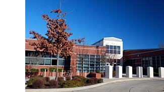
In recognition of this seismic risk, Oregon has taken measures to mitigate and prepare for the inevitable destructive earthquakes and tsunami. In the 1990s, Oregon began to revise the Uniform Building Code to reflect the recent research showing the higher risks from earthquakes[3]. Many schools, public buildings and critical infrastructure were built previous to the newer, more stringent codes, and are susceptible to failure in a seismic event. According to a 2007 Oregon Department of Geology and Mineral Industries (DOGAMI) report, over 1000 schools and 200 emergency facilities are at a high or very high risk of “probability that the building will collapse if ground motions occur that are equal to or exceed the maximum considered earthquake at that location.”[4]
[1] http://www.pnsn.org/INFO_GENERAL/faq.html. Retrieved June 24, 2009
[2] http://www.oregon.gov/DOGAMI/earthquakes/EQs.shtml. Retrieved June 24, 2009
[3] http://quake.usgs.gov/prepare/factsheets/PacNW/. Retrieved June 24, 2009
[4] DOGAMI Open-File Report O-07-02. p. iv.
Subscribe to:
Post Comments (Atom)


No comments:
Post a Comment